
San Benito ZIP Delivery Coverage
The city-facing ZIP for San Benito is 78586. The San Benito Post Office is at 200 W Hicks St., and official city and appraisal-district addresses consistently use San Benito, TX 78586. That establishes a dependable starting point for a city address, but not a municipal-boundary map. The nearby values in the table have a documented postal-service relationship to the San Benito facility. They are included to prevent a common mistake: a facility service list does not turn Los Fresnos or Rio Hondo into San Benito city areas.
| ZIP | Areas Covered | Post Office | Notes |
|---|---|---|---|
| 78586 | San Benito city addresses | San Benito Post Office, 200 W Hicks St. | City-facing ZIP; postal routing does not mark the city limit |
| 78566 | Nearby postal-service relationship, not a San Benito city claim | Los Fresnos Post Office, 301 W Ocean Blvd. | USPS Connect listed San Benito facility service; verify the exact address |
| 78583 | Nearby postal-service relationship, not a San Benito city claim | Rio Hondo Post Office, 109 E Colorado St. | USPS Connect listed San Benito facility service; not evidence of city limits |
USPS Connect's 2021 table lists 78566, 78583, and 78586 as served by the San Benito facility. Current USPS facility results identify 78566 with Los Fresnos and 78583 with Rio Hondo. Use those facts as a postal-service connection only. An exact address can have a San Benito mailing label near or outside a city boundary, and a boundary question needs city Planning, the ETJ or city-limits maps, county GIS, and the legal description rather than a ZIP alone.
The USPS San Benito Post Office location page identifies the local postal facility used for the city-facing ZIP.
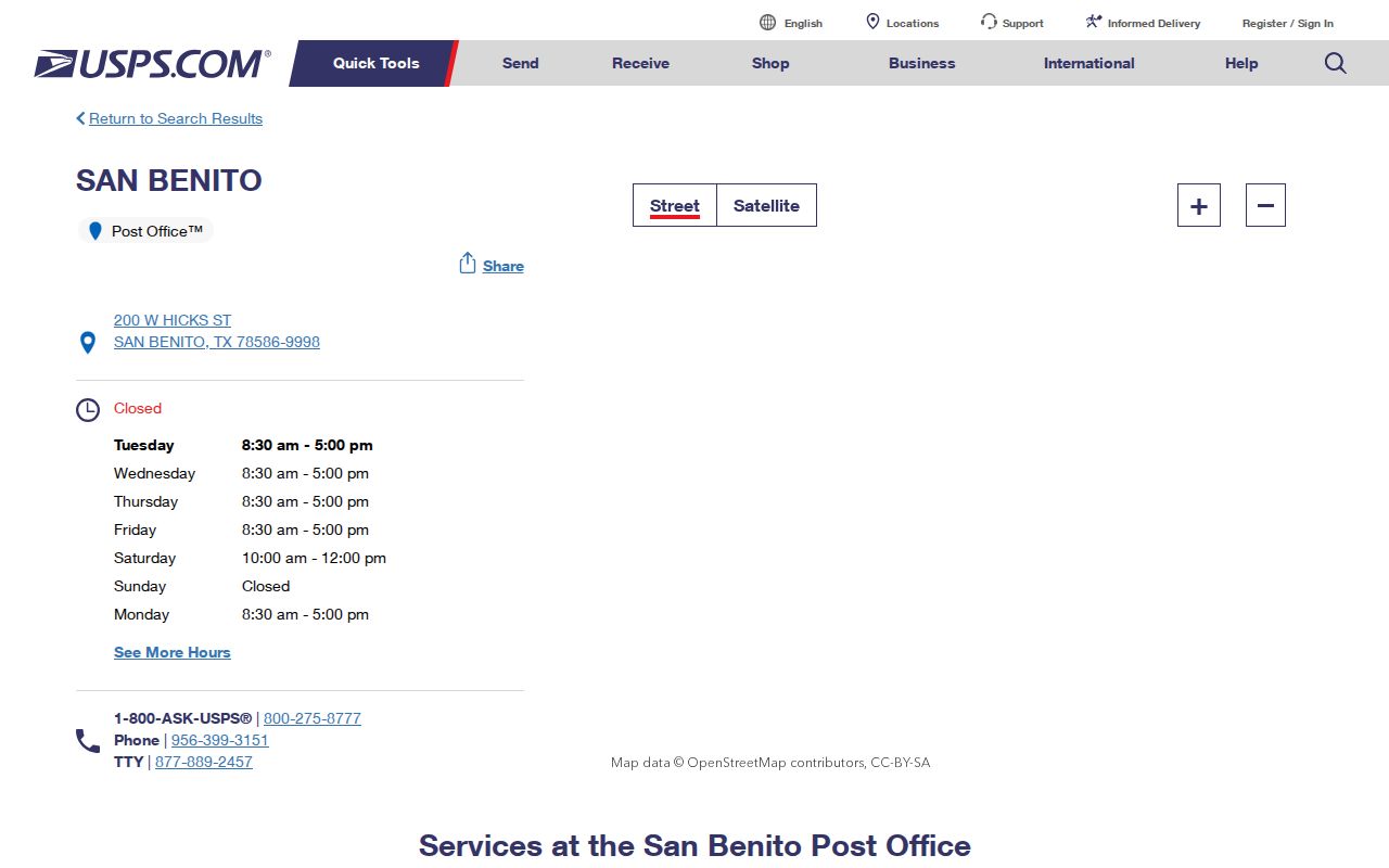
The facility listing supports the postal starting point, while the USPS address tool supplies the current answer for an individual delivery address.
Confirm a San Benito ZIP
The USPS ZIP Lookup tool is the authoritative current-deliverability check. It has three verified modes: Find by Address, Find by City & State, and Find Cities by ZIP. For a particular record, use the exact-address mode first. A city name alone can be broad, while an old deed or newspaper may use a historic street form. If the first search fails, compare the street spelling with the parcel record or historical map rather than guessing at a nearby postal area.
| USPS mode | Verified fields | Use |
|---|---|---|
| Find by Address | Street, city, state, or street plus ZIP | Confirm the current delivery ZIP for one exact address |
| Find by City & State | City and state | Identify postal choices to refine with an address |
| Find Cities by ZIP | ZIP | Check the postal city association for a known value |
- Write the street number, street name, city, and state exactly as the record gives them.
- Use USPS Find by Address with the street, city, and state, or the street plus a known ZIP.
- Save the returned mailing city, ZIP, and ZIP+4 with the date checked. Do not overwrite the record's historic address form.
- If the result differs from the record, search a variant street spelling and compare the parcel's legal description or map position.
- For a city-boundary question, compare the confirmed postal result with Planning's city-limits and ETJ maps and county GIS.
The postmaster finder can support historical research by first-three-digit ZIP ranges, but USPS warns that its records may not be current. It is not a boundary authority. A precise current postal response and a municipal map are separate checks, both worth retaining with the record date.
San Benito ZIP Boundary Checks
ZIP boundaries are postal delivery areas. City limits are municipal boundaries. Those systems can disagree locally: a San Benito mailing city and 78586 can appear near or outside the municipal line, while an address inside a city-limits map can be served through another postal route. County addressing also has a role. The Cameron County Emergency Communication District assigns rural addresses outside city limits and in Primera and Combes, which can complicate a mailing-label assumption.
San Benito Planning links zoning, flood, annexation, land-use, city-limits, and ETJ maps. County GIS and Transportation adds roads, developments, subdivisions, and map-printing context. Use those sources when a public record carries a different jurisdiction label from the mailing address. They are especially important around unincorporated territory, where a postal city can sound more definite than the parcel geography actually is.
San Benito Parcel Search Limits
Cameron CAD is an address and parcel tool, not a verified ZIP-wide directory. Its Property Search accepts an owner name, physical address, PID, or GEO ID. The inspected static material does not confirm a ZIP field, a ZIP filter, or a whole-ZIP export from the live search. The CAD Map Search and the county CivicAccess guide document address and parcel searching, including partial-address autocomplete, but no ZIP search field was documented there either.
Start with the individual address confirmed through USPS, then preserve the CAD PID or GEO ID, physical address, mailing address, and legal description as separate values. A CAD mailing address can be outside the parcel, and a name result is not proof that a person is at the physical address. For a street-by-street parcel method after that first match, use the San Benito street directory.
CAD's 2026 data page advertises appraisal and GIS exports, including very large files. Those are downloadable or requestable datasets, not evidence that an ordinary browser search can filter every record by ZIP. The inspected research did not capture an export schema that confirms ZIP fields, so the file layout must be checked before treating it as a ZIP resource.
San Benito Voter ZIP Fields
Texas provides two distinct voter routes. The public MVP lookup is person-first: it uses a name, date of birth, county, or an alternate identification path. It is not an openly browsable ZIP roll. For San Benito, Cameron County is the county selection. A live named local result was not captured during the research, so a result format or availability should not be assumed beyond the official guidance.
The Texas voter-file request form has permanent-residence and mailing fields that include ZIP values. It also includes county code, precinct, names, status, and other fields. A request for public voter information remains subject to current authorization, fee, delivery, and use instructions. The inspected form did not provide a verified fee or turnaround. Social Security, driver-license, and DPS identification information are confidential, and protected voters can have separate handling.
ZIP can help organize a properly obtained file, but the field does not prove present occupancy or city jurisdiction. Keep a registration address, mailing address, mailing ZIP, and parcel address distinct when they differ. Cameron County Elections is the in-person or phone fallback for current voter-file questions and protected-record guidance.
San Benito Address Keys Beyond ZIP
Postal routing is only one identifier in a San Benito record trail. A parcel can retain its legal description when a street is renamed or a number changes. CAD separates the physical or situs address from the mailing address, and county deeds use the legal description. Preserve all of them before trying to merge results from a newspaper, map, appraisal account, or official record.
- ZIP
- A postal routing value used to sort delivery areas. It is not a legal city-boundary identifier.
- ZIP+4
- An added delivery detail returned by the USPS tool for a specific address. Record it with the date checked.
- PO box
- A postal box address. It may be a correspondence location and does not identify the location of a parcel.
- Carrier route
- A postal delivery grouping. It can help describe delivery operations but does not establish city limits or parcel ownership.
Lot, block, subdivision, and metes-and-bounds descriptions are deed keys. They can bridge old newspaper references or historical maps when the current street form does not appear in an older source. A city map, county parcel map, and deed should be compared before deciding that two similarly named addresses are the same place.
San Benito Postal History
Older postal labels deserve a separate note. Service began as Diaz in 1905, changed to San Benito in 1907, and the post office moved in 2001. The former post-office site at 401 N Sam Houston was later restored and rededicated as a municipal building in 2006. An early Diaz reference in a newspaper or map can therefore be a postal-name clue, not evidence that a person changed places.
Search both Diaz and San Benito when checking early local newspapers, maps, and archive files. The 1945-2005 regional telephone-directory collection also predates some current postal conventions. Use the printed city, street, telephone exchange, and issue date as the historic evidence rather than assigning a modern postal value to an old listing.
San Benito ZIP Verification Steps
A careful ZIP search moves from the exact address outward. Confirm delivery with USPS. Locate the physical address or PID in Cameron CAD. Compare city-limits and ETJ information in San Benito Planning and county GIS if jurisdiction matters. Then use the relevant official record channel: an address-based CivicAccess search for county inspection context, a city request for municipal records without a public index, or a properly authorized voter-file request when a person-first search is appropriate.
Keep the limits visible in the result notes. No CAD ZIP-wide search has been documented, and no public MVP ZIP browse has been verified. County tax downloads may include address or ZIP columns depending on the file schema, but that schema was not captured. The practical answer is to verify each address and retain the postal, parcel, and municipal facts separately instead of turning a nearby ZIP into a citywide claim.